300 years of mining history
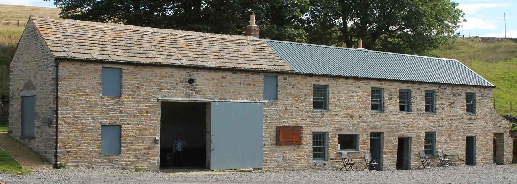
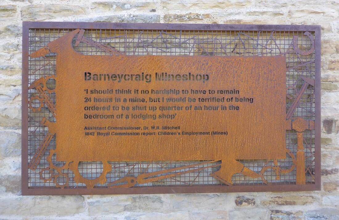
Barney Craig mine shop is located on the site of the former Carrshield Mine in the West Allen Valley. It used to be the largest mine shop in the region. There are the remains of over three centuries of mining at the site. The earliest known mining activity at the site was a level opened in 1760s and the mine continued to be in use throughout the 19th century.
The old mine shop is an important feature of the area's industrial heritage and has therefore been designated as a Scheduled Ancient Monument.
In 2017, at imminent risk of collapsing beyond repair, the building was gifted by Allendale Estate to Allen Valleys Enterprise in a critical condition.
With funding from Historic England and the Heritage Lottery Fund, during 2017-18 the building was renovated using traditional methods and existing materials to be preserved and to serve as an asset for the local community. The upper floors have now been opened for use as a no-frills Camping Barn - a weather-proof stopover for walkers, cyclers and dark sky astronomers exploring the area.
|
|
Carrshield lead mines and ore works
https://historicengland.org.uk/listing/the-list/list-entry/1015849
- Heritage Category: Scheduled Monument
- List Entry Number: 1015849
- Date first listed: 08-Jul-1997
Reasons for Designation
Approximately 10,000 lead industry sites are estimated to survive in England, spanning nearly three millennia of mining history from the later Bronze Age (c.1000 BC) until the present day, though before the Roman period it is likely to have been on a small scale. Two hundred and fifty one lead industry sites, representing approximately 2.5% of the estimated national archaeological resource for the industry, have been identified as being of national importance. This selection of nationally important monuments, compiled and assessed through a comprehensive survey of the lead industry, is designed to represent the industry's chronological depth, technological breadth and regional diversity. Nucleated lead mines are a prominent type of field monument produced by lead mining. They consist of a range of features grouped around the adits and/or shafts of a mine. The simplest examples contain merely a shaft or adit with associated spoil tip, but more complex and (in general) later examples may include remains of engine houses for pumping and/or winding from shafts, housing, lodging shops and offices, powder houses for storing gunpowder, power transmission features such as wheel pits, dams and leats. The majority of nucleated lead mines also included ore works, where the mixture of ore and waste rock extracted from the ground was separated ('dressed') to form a smeltable concentrate. The range of processes used can be summarised as: picking out of clean lumps of ore and waste; breaking down of lumps to smaller sizes (either by manual hammering or mechanical crushing); sorting of broken material by size; separation of gravel-sized material by shaking on a sieve in a tub of water ('jigging'); and separation of finer material by washing away the lighter waste in a current of water ('buddling'). The field remains of ore works vary widely and include the remains of crushing devices, separating structures and tanks, tips of distinctive waste from the various processes, together with associated water supply and power installations, such as wheel pits and, more rarely, steam engine houses. The majority of nucleated lead mines with ore works are of 18th to 20th century date, earlier mining being normally by rake or hush and including scattered ore dressing features (a 'hush' is a gully or ravine partly excavated by use of a controlled torrent of water to reveal or exploit a vein of mineral ore). Nucleated lead mines often illustrate the great advances in industrial technology associated with the period known as the Industrial Revolution and, sometimes, also inform an understanding of the great changes in social conditions which accompanied it. Because of the greatly increased scale of working associated with nucleated mining such features can be a major component of many upland landscapes. It is estimated that several thousand sites exist, the majority being small mines of limited importance, although the important early remains of many larger mines have often been greatly modified or destroyed by continued working or by modern reworking. A sample of the better preserved sites, illustrating the regional, chronological and technological range of the class, is considered to merit protection.
Despite the fact that there has been later mining developments at the Carrshield lead mines and ore works, significant remains survive. The site retains a good number of components including the largest lodging house in the north Pennines and an intact washing floor beneath later waste heaps.
Details of the site
The monument includes the remains of two lead mines and an ore works, situated on the base and lower slopes of the valley of the West Allen at Carrshield. The visible remains of the lead industry at Carrshield are complex and represent several phases of mining over three centuries. The latest phase of the mining dominates, although earlier remains will survive beneath these, as well as in the areas untouched by later mining. The earliest known mining activity at the site was the Barney Crag Horse level, situated at the southern end of the complex; this mine was opened during the 1760s and continued in use throughout the 19th century. The access to this mine was through an adit, or horizontal tunnel into the valley side. The round arched tunnel of roughly squared rubble construction is Listed Grade II and visible 10m south west of a large lodging shop. The two storeyed lodging shop, which is the largest in the north Pennines, retains original internal features including several arched furnace openings and a blacksmiths' forge. Inside and surrounding the lodging shop there are a series of culverts, some of which are thought to have been used to drain the mines; others are thought to be related to the water management system associated with ore processing at the northern end of the monument. The second mine at the complex was Scraithole Mine which was operated during the 19th century by the Beaumont Company, and was reopened in the 1950s when it continued to be operational until 1981. Access to this mine was also through an adit; the entrance is situated on the left bank of the river immediately east of the track to Greenpit, opposite Bluerow Cottages. As well as the underground adit, lead ore could be exposed by directing torrents of water across the line of the vein; the action of the water often resulted in a water-cut ravine or a hush. Two water cut features 12m to 14m wide, thought to be hushes, are situated on the left bank of the river immediately opposite the lodging house. It is uncertain exactly which phase of mining they relate to though they are thought to be of 19th century date. Situated at the northern end of the monument, on the western side of the river where it overlies an earlier lynchet, is an extensive spoil heap associated with the mining activity at the site. There is also evidence at the Carrshield complex for the processing of ore prior to smelting. Once the lead ore had been recovered from the mines it was stored in tall stone containers known as bouse teams; there are the remains of a series of bouse teams 26m long in the central area of the monument. These have been modified in later years but their 19th century form is still visible. To the north of the bouse teams, is the washing floor where many of the ore processing operations intended to wash and sort the ore from unwanted impurities were carried out. This area is now covered by later dressing waste but it is thought that much of the original washing floor survives beneath this waste. Underlying earthwork features are visible at the northern end of these waste heaps. The Ordnance Survey first and second edition plans (1859 and 1895) show the positions of the small structures and tanks used during these processes. The third edition plan of 1919 indicates more buildings and additional tanks in this area. The washing floor was supplied with water from a complex of culverts visible in the vicinity of the lodging shop. Two large reservoirs, measuring 50m by 12m and 65m by 20m, situated on the right bank of the river above the washing floor are thought to have operated as settling tanks. Once the ore had been sorted further processess were used to break it into smaller pieces; one method was the use of a mechanized crusher and documentary sources refer to the existence of a crushing mill at Barney Crag during the 1860s and 1870s, although its exact position is unknown. The River West Allen runs through the centre of the complex. It is revetted with stone walls; it is thought that the revetment originally carried arches of 19th century date along the whole of its length to support a raised floor providing an extension to the area provided for the washing floor. A number of these arches survive. The stone wall revetment on the eastern side of the river is Listed Grade II. The early 19th century bridge which carries the track across the river to Greenpit and a portal and chamber of a drainage tunnel 20m to the east of the bridge are also Listed Grade II. The complex also includes the remains of a railway line and several tracks giving access to the waste heaps, and a series of ways on the east side of the river above the washing floors. The track ways are thought to relate to the working of these areas as well as giving general access to the complex. The concrete sheds adjacent to the Scraithole adit, the concrete shed immediately north west of the bouse teams, and the metalled surfaces of all roads, tracks and fences which cross the monument are excluded from the scheduling, although the ground beneath them is included.
SOURCES
- Legacy System number: 28541
- Legacy System: RSM
- Books and journals: Bowden, M, Barney Crag Industrial Complex, (1992); Ian Forbes, (1996)
Legal
This monument is scheduled under the Ancient Monuments and Archaeological Areas Act 1979 as amended as it appears to the Secretary of State to be of national importance. This entry is a copy, the original is held by the Department for Digital, Culture, Media and Sport.